
Here we are on the “Italian Riviera”
 We left Florence this morning, stopped st Pisa, and moved on to Santa Margherita Ligure. This is a small coastal town just south of Genoa.
 Here is our room in the Hotel Jolanda. It was a nice clean room with a great view of the alley, but it was in the center of town near the beach.
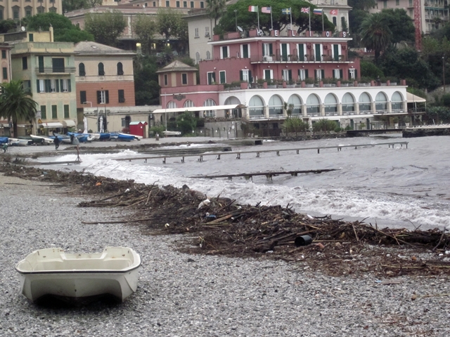 Here is the beach. The beach was a mess. An ocean storm had recently hit Genoa (to the north) and the after effect here was a beach littered with big mounds of debris. Mary Ann and I went looking for sea glass, but there was too much junk and plastic on the beach so we didn’t find any any (I make jewelery out of sea glass that is sold to the summer tourists in a local jewelery shop in Kennebunkport, Maine).
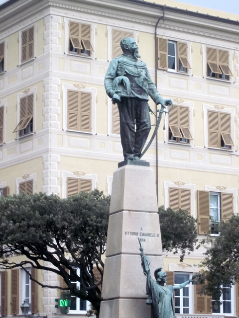
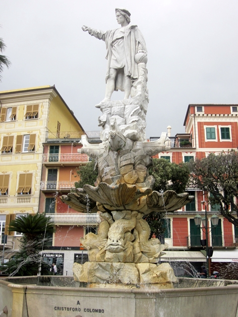
There are two statues on the waterfront: One of Victor Emmanuel, Italy’s first president (remember the big white Victor Emmanuel Memorial in Rome?). The other was of Christopher Columbus, a native Italian who came from Genoa. He is looking west to the New World.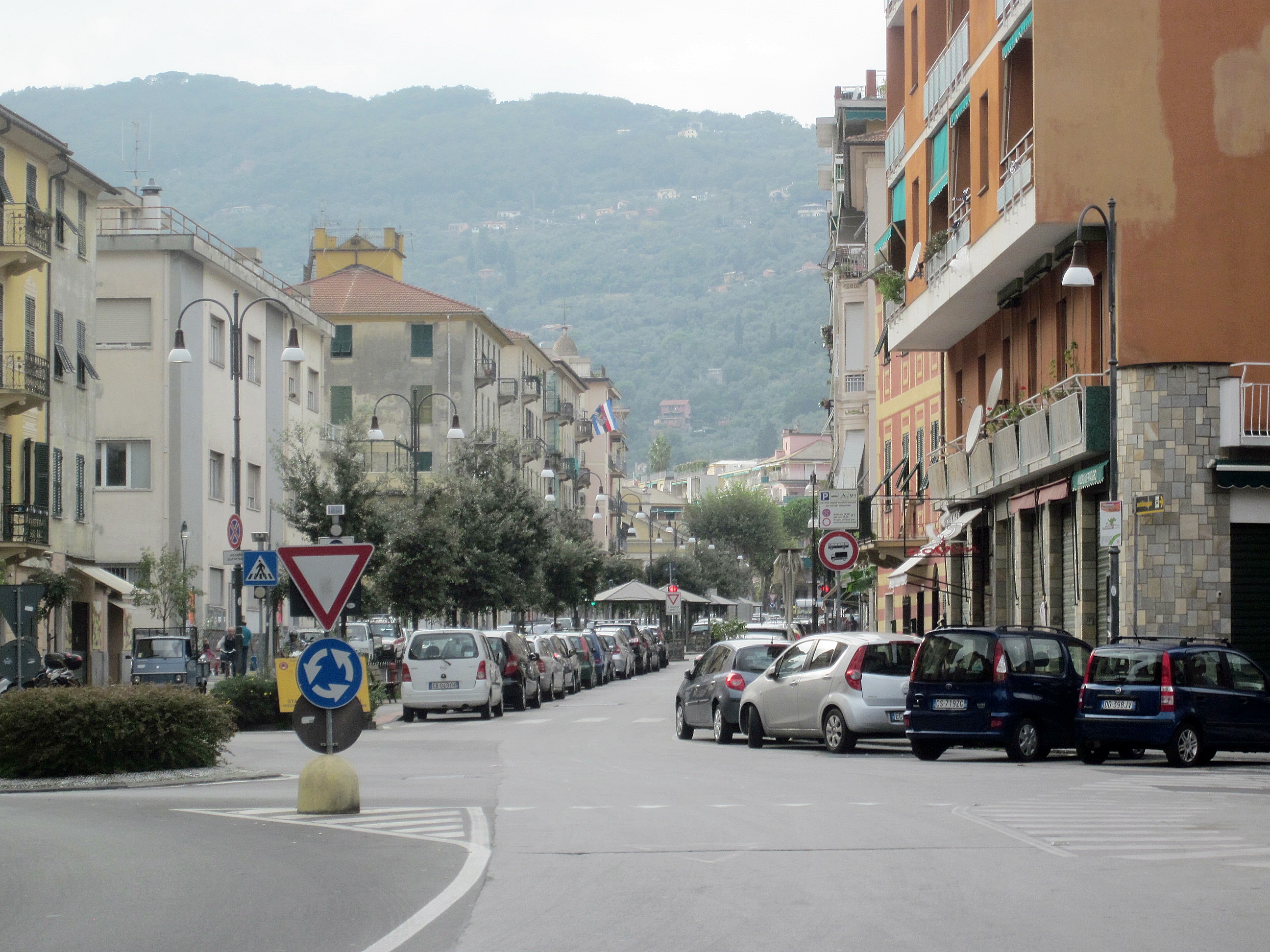
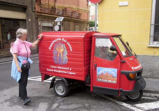 We walked around town, looked at unusual vehicle, and then joined the group for a delicious fish dinner (Bream) at a small local restaurant. After that, we returned to hotel and, after our long busy day, we conked out.
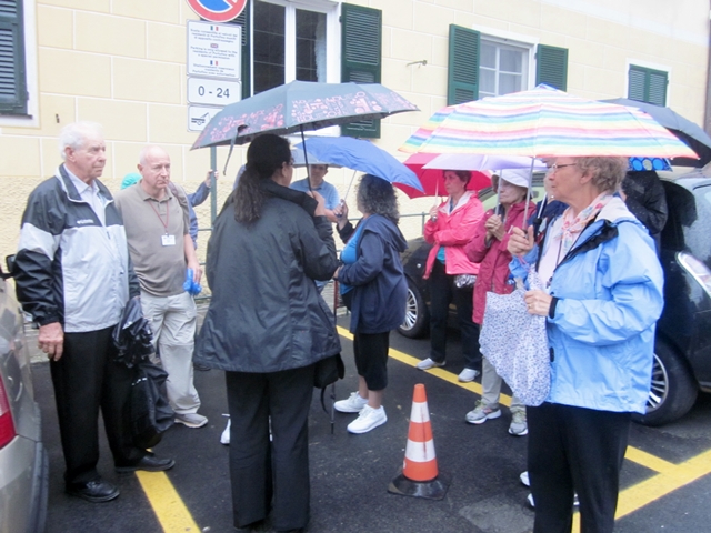 In the morning, after breakfast, we gathered with Eva to catch a bus to Portofino. Today was originally a planned GCT Excursion by boat from Santa Margherita to Portofino. The seas were angry that day and it was off and on rain. The remnants of the Genoa storm.
We waited for over an hour for a city bus to Portofino and finally half of us crowded onto a bus with half of another tour group . We all were “not happy campers”.
 We arrived at Portofino in the drizzle, walked down their short main street to the harbor and up a paved trail to a pretty little church and cemetery overlooking the town.
 This is our gloomy view Portofino harbor from the church. Not much happening there on this crappy morning. I did find some sea glass on a bit of beach neat that white dot on the waterfront.
 From our helicopter, on a nice day, this is what Portofino really looks like. Most small town along this coast look similar: Built at the base of a narrow ravine that becomes a river during a heavy rain.
 The weather improved and we got tired of waiting for a bus back and decided to hoof it. Our 3 mile walk back to town started OK. It was dry and pleasant.
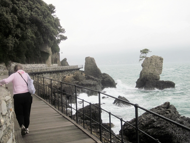 We rounded a bend and left the shelter of the hills. The wind and waves now hit us. We were too far along to turn back so we pressed on., Mary Ann had to hang on to keep from blowing off the boardwalk. I don’t know how that little tree on the rock hung on…
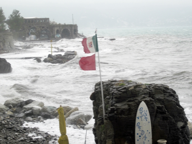 Eventually, we walked through a full blown gale. No rain, but lots of wind and waves crashing over the road. Note the red flag: Small craft warning. Note the Italian flag. It has an emblem in the middle. This signifies the coat of arms of the Italian Navy. The quarter emblems refer to the four Maritime Republics before unification:
1st quarter: on red, a golden winged lion (Republic of Venice);
2nd quarter: on white field, red cross (Republic of Genoa);
3rd quarter: on blue field, white cross (Republic of Amalfi);
4th quarter: on red field, white cross (Republic of Pisa).
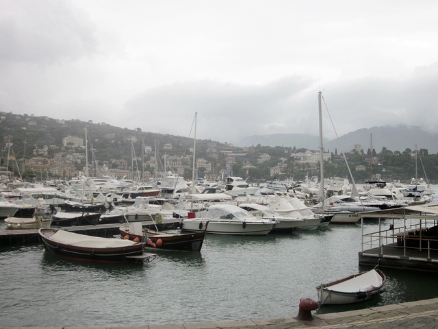 Enough about wind and waves. It was late in the afternoon when made it back to Santa Margherita and it’s quiet sheltered harbor.We thought we here home free, but we were just in time to get caught in a driving rain storm. The streets were rivers and people were seeking shelter in stores and restaurants.
Since dinner “was on our own’, and we were wet, we went to the local “Cespar” and bought cheese, crackers, fruit, and wine and dined in our hotel room.
So endeth our stormy day in Portofino.
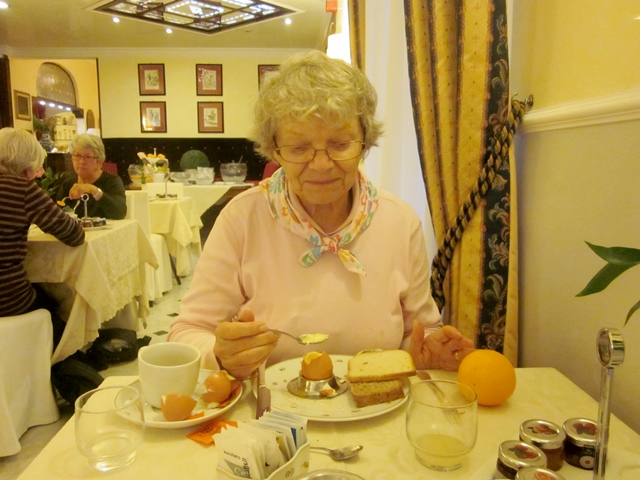 The next morning We had a hearty breakfast in the hotel. Mary Ann cooked a boiled egg and I had mine scrambled (with ketchup) and bacon, followed by a nice flaky croissant with jam. We had a big pot of coffee, too. We also made sandwiches of meat and cheese for our scavenged lunch.
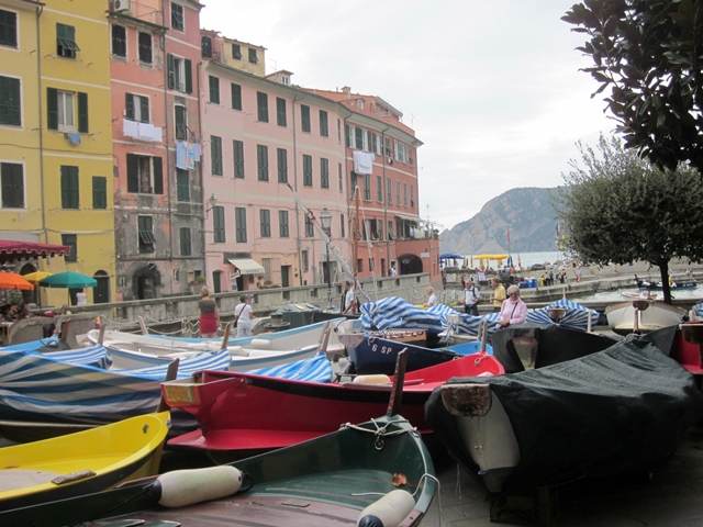
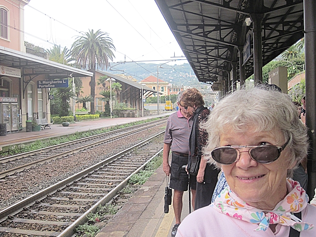 Due to yesterday’s aborted boat trip to Portofino, Eva (quite nicely) offered to escort us by train to visit two of the five “Cinque Terre” villages: Veranzza and Manarola. We left the Santa Margherita RR station.
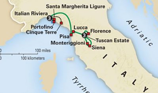
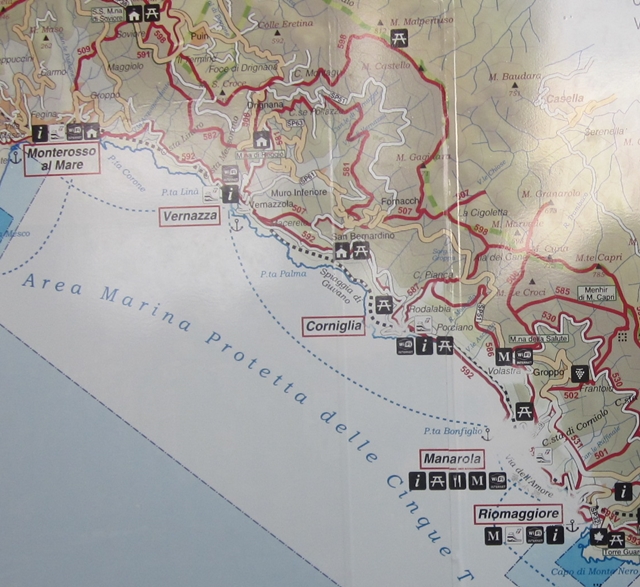 This is a little map of the Cinque Terre area. The train route is the dotted line near the coast. Note all the squiggly roads. That tells you that the terrain here is extremely rugged and steep and road traffic is difficult, dangerous, and slow. The train goes on a straight line because, at each place where the mountains go to the water, there are tunnels.
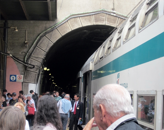 In fact, the RR Station in Veranzza is between a place we the train exits one tunnel and enters another. There are only a couple hundred yards separating tunnel openings.
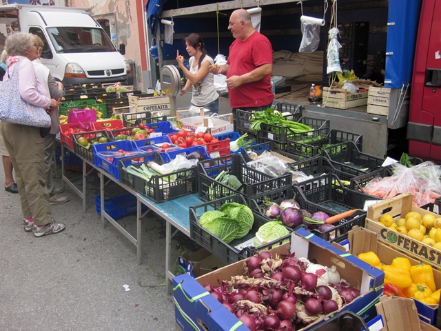

 There were veggie and flower stands, Tee shirt shops, and restaurants along the main street leading to the harbor.
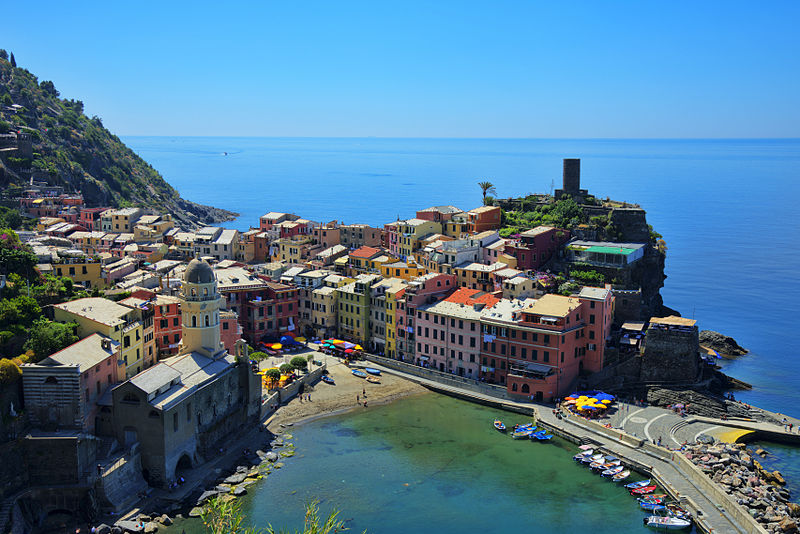 It was a nice day when our ‘copter took this picture. When we were there, the weather also nice and we ate our lunch on the breakwater by the fishing boats. You can see how small the town is and how steep is the mountain drop to the sea. These villages are tucked into little coves that indent the mountains.
The coastline, the five villages, and the surrounding hillsides are all part of the Cinque Terre National Park and is a UNESCO World Heritage Site.
Over the centuries, people have carefully built terraces on the rugged, steep landscape right up to the cliffs that overlook the sea. Part of its charm is the lack of visible corporate development. Paths, trains and boats connect the villages, and cars cannot easily reach them from the outside. The Cinque Terre area is a very popular tourist destination.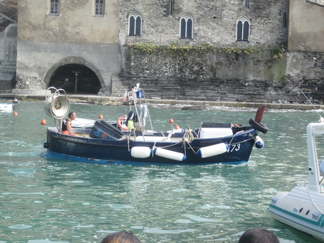
 Here is a fishing boat in the harbor and a lot of them pulled up on the boat landing.
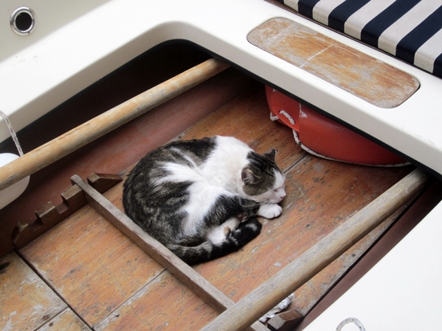 On our way back to the Station to continue on to Manarolo, we found a sea cat snoozing in a boat (instead of a sea dog).
 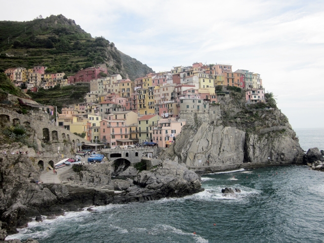 This is Manarolo. It’s on a rugged cliff above the sea. It was so rugged that the train station is on the other side those cliffs. There is a pedestrian tunnel to get back into town. The harbor (?) entrance is just past those rocks.
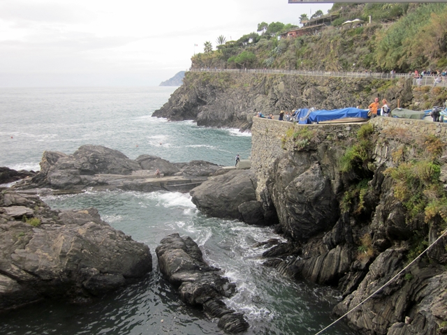 This is the Manarolo harbor. Tricky landing, indeed! Off in the distance you can see path cut into or hanging on to the cliff. That is a part of the Sentiero Azzurro trail that connects the five villages of the Cinque Terre. The total time it takes for the hike of about 7.5 miles is about 5 hours, but obviously the walk can be divided in halting-places in every village.
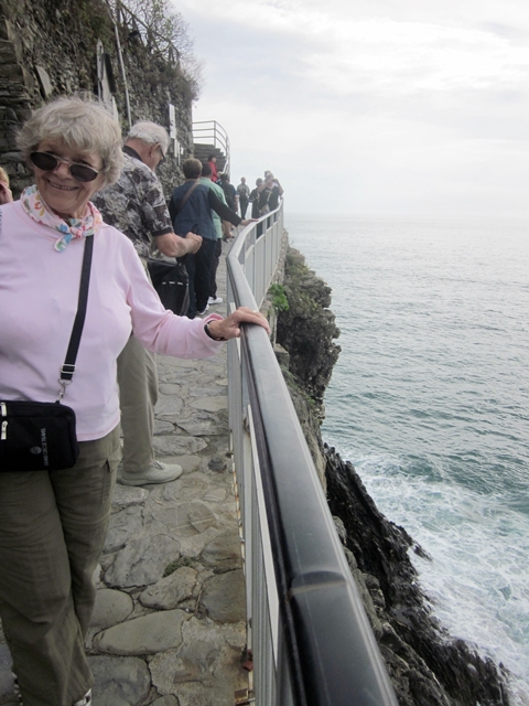
We walked about 3/4 mile and were stopped by a gap in the trail caused by the recent storm. We caught the next train back to Santa Margherita and I noticed another small beach on the map.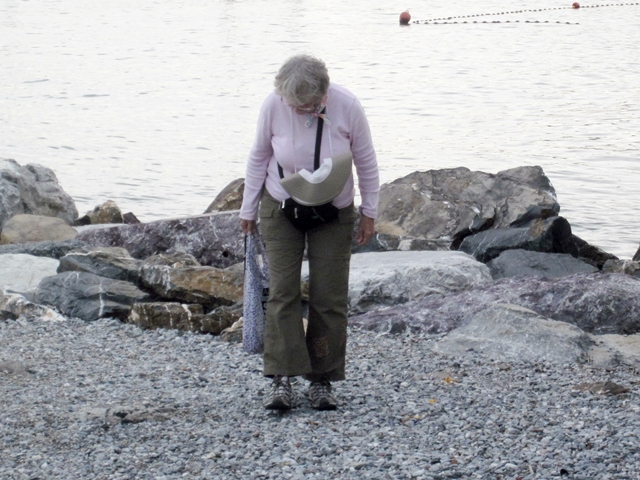 When we got off the train, we found this beach. Mary Ann and I searched for and found some sea glass here. I brought home a small zip lock bag full, which I’ll tumble a bit and make some “Portofino Sea Glass Jewelery’. Let’s see if it sells…
We joined our group for a nice dinner in the hotel and hit the hay.
So endeth our visit to the Italian Riviera.
On to Bolsano with a stop in Verona.